As we explained in a previous blogpost, the so called Sister Projects of the EuroGEO Action Group...
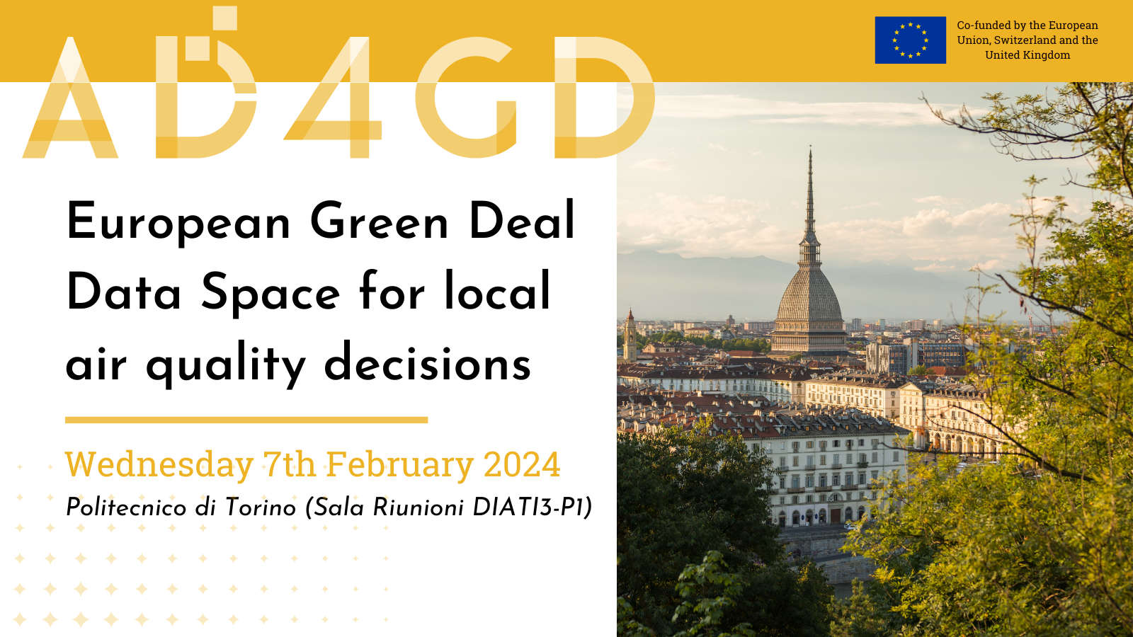
European Green Deal Data Space for local air quality decisions
Air quality in urban environments is a matter of public health, environmental sustainability, and fortifying the resilence of our cities against the challenges of climate change. Nowadays it is commonly shared that decision-making in this regard needs to be based on reliable data that comes from scientific sources. For this reason, having access to scientific data in a simple, integrated and interoperable way can help both policymakers and citizens as a whole to understand the existing pollution levels and implement targeted strategies.
In this sense, the European Strategy for Data aims to create a single data market that guarantees Europe’s competitiveness and data sovereignty. To this end, the creation of several common European data spaces will ensure that more data is available for use, while maintaining control of those who generate it. The European Green Deal Data Space is one of them, that will adress three main objectives: biodiversity conservation, water pollution and climate change.
At the user level, there are two main reasons for not being able to access data: either you do not know that data exists or, although you know that this data exisits, they cannot be accessed. In this event we want to overcome these two barriers by putting on the table the needs of those people who generate and store data, as well as those who want to use it in order to help in the design of a usefull European Green Deal Data Space. On this occasion and due to its important role for health and climate resilience, we will work on urban air quality data..
We invite you to participate in this open day if you are a person in charge of managing or designing air quality measures in cities, if you are a provider of air quality data or if you are a citizen or group committed to this problem and want to support the availability of scientific data for desicion making.
It is necessary to register in the following form: REGISTRATION FORM
You can find the program in the following link: FULL PROGRAM
Hourly Schedule
Wednesday 7th February
- 9.00 - 9.10
- Welcome and introduction to the workshop
-
Speakers:
Francesca Noardo - Open Geospatial Consortium (OGC)
- 9.10 - 9.45
- Who are we and why do we want quality data?
- Ice Breaking Activity
- 9.45 - 10.00
- The Green Deal Data Space and AD4GD
-
Speakers:
Joan Masó - CREAF
- 10.00 - 10.10
- High Value Datasets, data requirements, standard data models & metadata
-
Speakers:
Alba Brobia - CREAF
- 10.10 - 11.00
- Data requirements definition
- Participatory Exercise
- 11.00 - 11.30
- BREAK
- 11.30 - 11.45
- FAIR Principles, Standards & API's. Data Spaces Concept
-
Speakers:
Joan Masó - CREAF
- 11.45 - 12.00
- Collaboration kills Competition
-
Speakers:
Lukas Mocek - Sensor.Community
- 12.00 - 12.15
- Research on air pollution, methods and applications
-
Speakers:
Davide Gallione - Politecnico di Torino, DIATI, Marina Clerico - Politecnico di Torino, DIATI
- 12.15 - 12.30
- Overview of air quality use cases in regione piemonte
-
Speakers:
Francesco Matera - Regione Piemonte
- 12.30 - 13.00
- Final Open Discussion
Speakers
-
 Joan Masó - CREAFPrincipal Investigador at CREAF and AD4GD Coordinator
Principal researcher leading the specialized group “Grumets” on geospatial interoperability, GIS, remote sensing. Since 1995 he is a researcher at CREAF and GIS developer. Co-creator of the MiraMon compressed map in 1997 that has evolved into a distribution and preservation format. Teacher in a RS and GIS master in the UAB. Creator of Remote Sensing imagery visualization and download software for web data portals (the MiraMon Map Reader).
-
 Marina Clerico - Politecnico di Torino, DIATIAssociate Professor and researcher.
Associate Professor at the Department of Environmental, Land and Infrastructure Engineering (DIATI). Her research mis focused on air pollution and quality monitoring, environmental impact assesment and occupational safety and health.
-
 Francesca Noardo - Open Geospatial Consortium (OGC)Project Manager in the OGC Innovation Program
Project Manager in the Open Geospatial Consortium Innovation Program. Her research is intended to support the integration of multisource spatial information, in particular of 3D geoinformation with Building Information Models (BIM) (GeoBIM), interoperability and F.A.I.R. principles in general.


