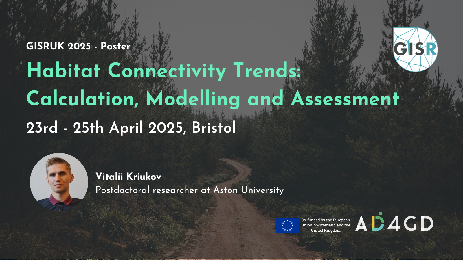
GISRUK 2025 – Habitat Connectivity Trends: Calculation, Modelling and Assessment
GISRUK is the annual GIS conference for researchers in the UK. The event gathers international researchers and practitioners from geographic information science and other related fields to put in exchange valuable insights on the latest advances in spacial computing and analysis. GISRUK features diverse topics ranging from fundamental research to methodological approaches and real-world applications of GIS across domains.
The AD4GD project will be present at the GISRUK with a poster presented by Vitalii Kriukov on the calculation, modelling and assessment of habitat connectivity trends. The poster will be exhibited in the foyer throughout the conference. A summary of the contribution:
A range of indices are available to calculate terrestrial habitat connectivity based on land-use/land- cover data. Two tools (Graphab and MiraMon) were used to create timeseries datasets (1987-2022) and build the pipeline to analyse trends in connectivity. Data4Land tool was developed to enrich LULC datasets with OpenStreetMap data. Habitat connectivity indices of forest-dwelling mammals and target species (Testudo hermanni) for Catalonia (Spain) were produced. In contrast to shrublands and meadows, forest connectivity mainly follows a positive trend, but considerable spatial differences are observed between Barcelona, protected areas and Pyrenees. The developed workflow supports decision-making and trade-offs between stakeholders in spatial planning.
A conference paper has also been published in the same context. You can read the full paper on Zenodo.
GISRUK 2025 is hosted by the School of Geographical Sciences at the University of Bristol.
- Apr 23 - 25 2025
- Expired!
- All Day
- Beacon House, Queens Rd, Bristol BS8 1QU, Reino Unido
Speaker
-
Vitalii Kriukov

Related News
- Three years of experience developing Green Deal Data Spaces: a chronicle of our final event
- Simplifying Data Accessibility: A Conversation with Pawel Babalski

- From University Project to the Green Deal Data Space: An Interview with Riyad Rahman

- Enhancing environmental data sharing: Policy brief Recommendations on Managing Data in the Green Deal Data Space