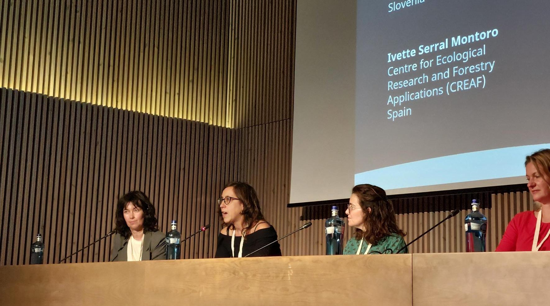
Ivette Serral (CREAF) during her intervention in the 5th Session of the 8th Mediterranean Forest Week, in Barcelona.
10 percent of the total surface of the Mediterranean countries is covered by forests. These are not only a valuable source of renewable biomaterials, energy and income for human beings, but also home for many of the 320 species of mammals which inhabit the Mediterranean basin. Small mammals are the most numerous, with the presence of a wide variety of rodents, bats, shrews, hedgehogs or moles. According to the IUCN Red List of Mediterranean Mammals, destruction and degradation of habitats, caused by a variety of factors including agricultural intensification, urbanization, pollution, and climate change, is their greatest threat with 16 percent of mammal species threatened with extinction and 27 percent facing declining populations.
Greater restoration efforts are needed for Mediterranean forests. This spirit guided researchers, policymakers, and stakeholders at the 8th Mediterranean Forest Week. This biennial event took place in Barcelona from the 4th to the 7th of November 2024. The AD4GD project took part in the event with a dedicated poster presented by Ivette Serral (CREAF) and Vitalli Kriukov (Aston University) showcasing our progress in relation to our pilot on biodiversity. Serral was also invited to participate in the panel session “Green Cities for Adaptation and Resilience: co-benefits for human health, environment and society “.
Combined information is key for urban greening
The 5th Session of the Mediterranean Forest Week focused on the co-benefits for human health, environment and society derived from green cities adaptation and resilience and was chaired by Corina Basnou (CREAF) and Michaela Coningliaro (FAO). After two keynotes by Matilda van den Bosch (EFI and ISGlobal) and Deema Assaf (TAYYÜN Research Studio), it followed a panel discussion integrated by Urša Vilhar (SFI), Eugènia Vidal (AMB), Ivette Serral (CREAF) and Elena di Pirro (University of Molise). Joan Pino, director of CREAF, was the rapporteur of the session and made some closing remarks.
The main lesson of the debate was the need for a sustainable transformation of cities into not only better places for people to live in, but also into havens of biodiversity. This will require planning based on green criteria, the use of technologies such as Remote Sensing and the Internet of Things to improve monitoring and evaluation methods, as well as public-private strategies grounded in evidence-based communication.
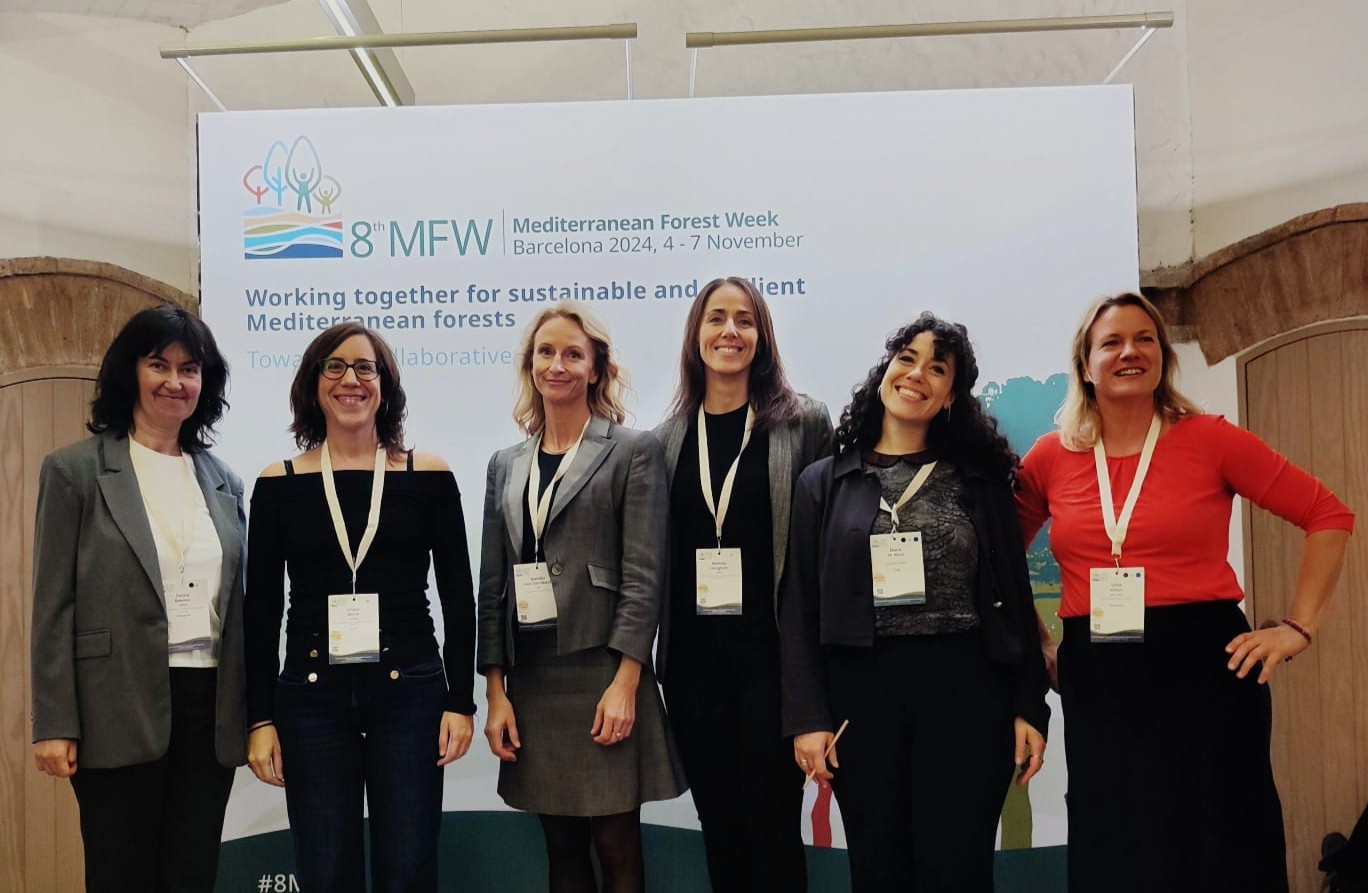
Panellists of the 5th Session of the 8th Mediterranean Forest Week
Regarding the role of Earth Observation in monitoring and managing urban green spaces, there was a special interest in the Green Deal Data Space initiative, as a single market for data from different origins. Serral emphasized that, while Remote Sensing is a vital monitoring tool, it should be integrated with ground-truth information coming from citizen science observations and Internet of Things devices specially at the spatial resolution required in Mediterranean cities management. This combined approach could enhance biodiversity monitoring and more effectively meet policy needs. Yet, some challenges remain in standardization and openness.
Connectivity in Catalonia: implications for forest management
Ecological corridors serve as essential habitat connectors, facilitating species migration across ecosystems such as forests and scrublands. These green corridors are emphasized not only in the EU Biodiversity Strategy for 2030 but are also critical for achieving a 5 percent net gain in the connectivity and integrity of natural systems, a key milestone set by the Convention on Biological Diversity.
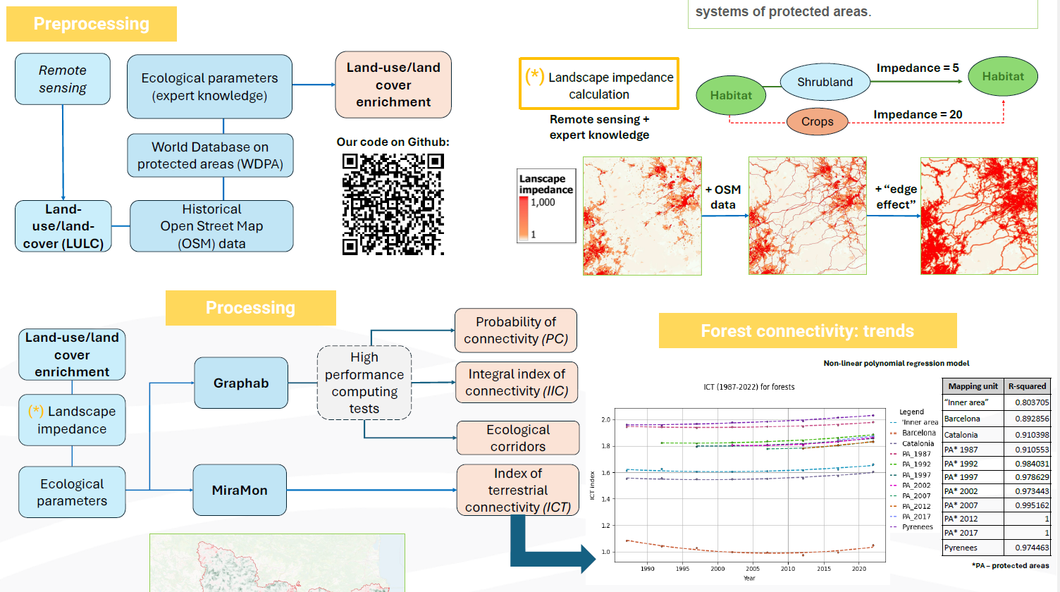
One of the goals of our biodiversity pilot is to enrich various connectivity indices—currently based primarily on land-use/land-cover maps from remote sensing—with additional information sources.
We are currently testing ways to enhance LULC maps generated from Remote Sensing data by incorporating historical OpenStreetMap data, the World Database on Protected Areas, and ecological parameters based on expert knowledge. This approach enables us to calculate various terrestrial connectivity indices and track connectivity trends for certain habitats, such as forests, as illustrated in the figure.
This work is expected to support the monitoring and evaluation of connectivity for key habitats in Catalonia. Our goal is to provide decision-makers and land managers with data-driven solutions to aid ecosystem adaptation and biodiversity protection.

