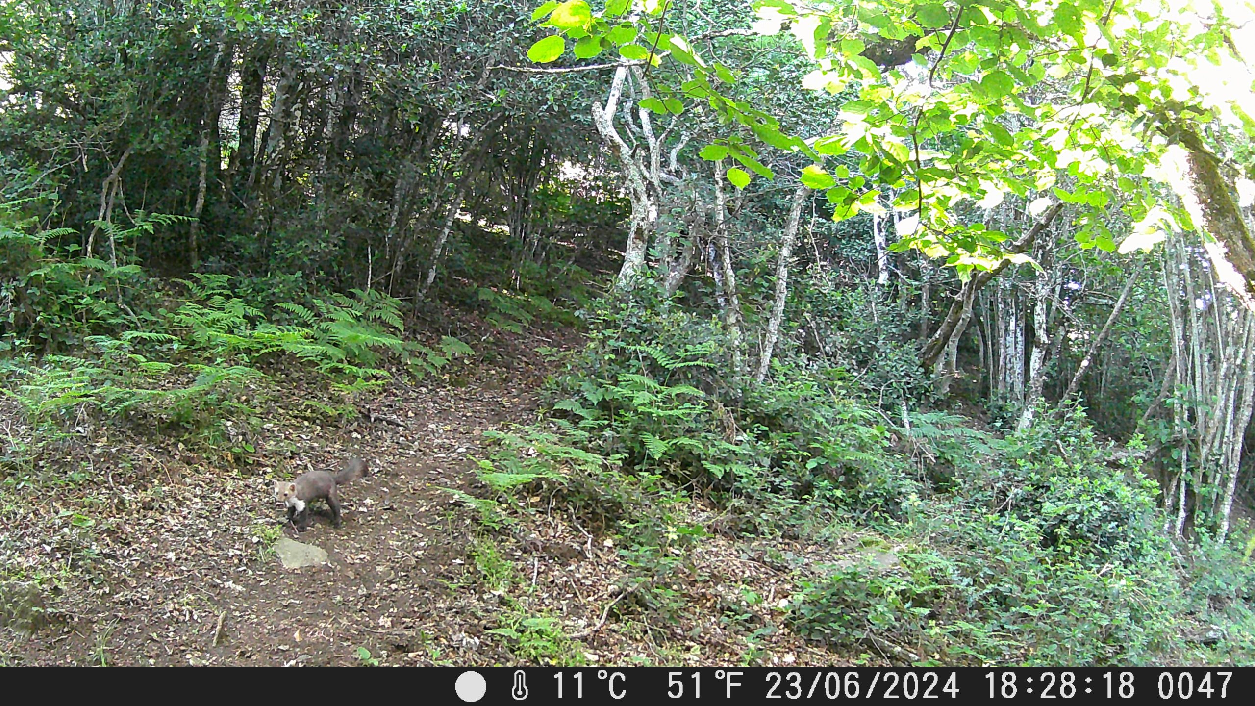
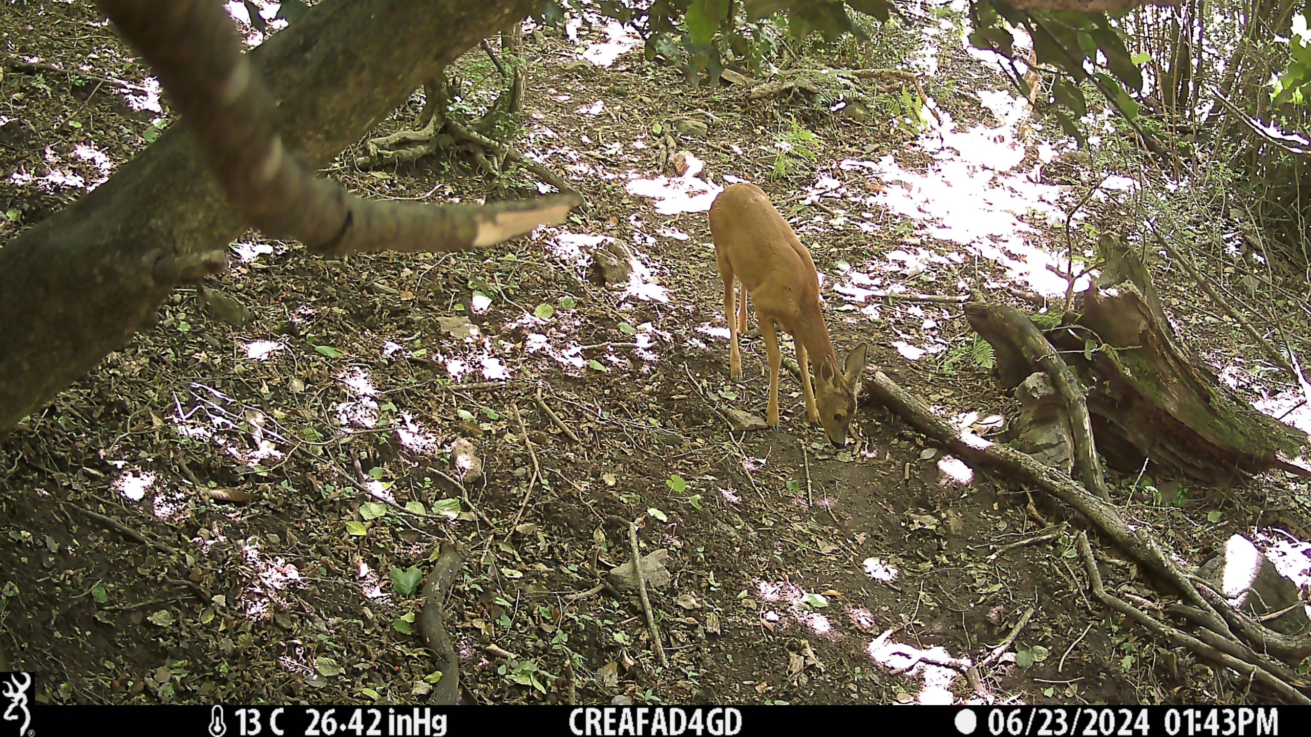
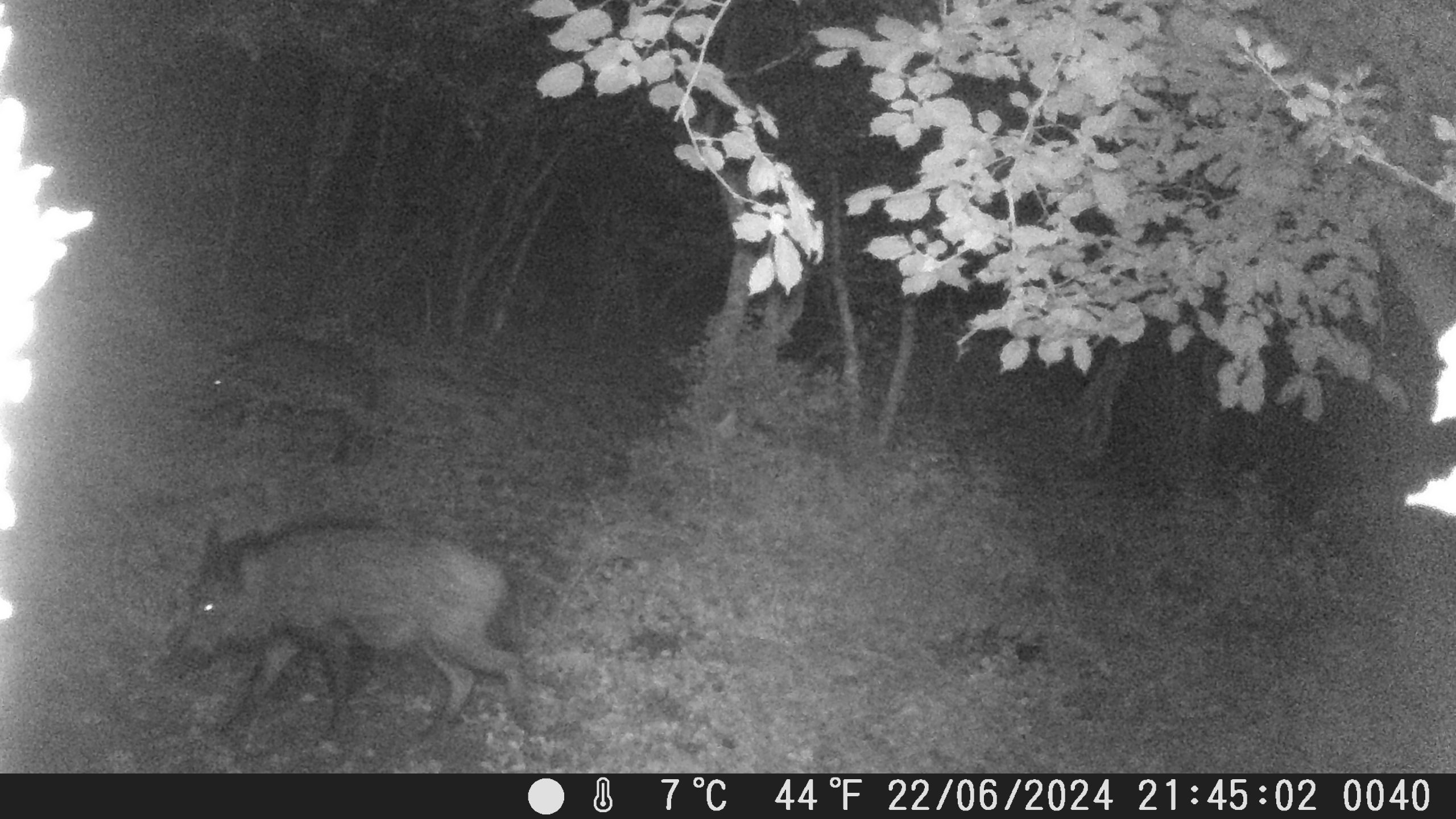
A camera trap captures images that carry a series of metadata that includes temporal references, the type of camera and its settings, among others. Author: Diego de la Vega.
CREAF researchers have installed three camera traps in La Albera Natural Park of National Interest as part of the AD4GD biodiversity pilot. They aim to detect Felis silvestris and Mustela putorius, a protected species and an endangered species, respectively. The researchers intend to use the collected data to test the standardized gathering of occurrence observations using the STAplus OGC Standard, which has already proven effective in homogenizing IoT and Citizen Science data.
This work is part of the biodiversity pilot activities and supports training for a master’s thesis by a student in Remote Sensing and Geographical Information System at Universitat Autónoma de Barcelona. The student has been integrated into the AD4GD team to undertake this task.
What is a camera trap?
A camera trap is a remote sensing device comprised of a camouflaged camera that is automatically triggered by a passive infrared sensor when it detects motion within its range of vision. Ecology researchers have long used camera traps to detect the presence of animals with minimal intervention, thereby saving time and avoiding the capture or disturbance of animal behavior.
Installing a camera trap requires following a specific procedure starting with obtaining permission from the property owners or the relevant authorities. The AD4GD team has been guided by the protocols established by the photo-trapping experts at the Carnivore Research Group of Catalonia (FELIS), part from the Catalan Institution of Natural History (ICHN).

A camera trap is a remote sensing device that is automatically triggered when it detects motion in its range of vision. Author: Diego de la Vega
Camera trap data comprises both embedded and non-embedded metadata. Embedded metadata includes information automatically recorded by the camera and integrated within the media files, such as temporal references, camera model, and technical settings. In contrast, non-embedded metadata encompasses additional contextual information about the camera trap deployment and project that is not automatically recorded by the camera. This includes among other, deployment information such as camera trap geographic location, project details, and species observations and classifications. Researchers and/or Citizen Scientists must manually record this non-embedded metadata and link it to the media files through data management systems, ensuring comprehensive documentation and facilitating robust analysis.
What is habitat connectivity and how to measure it?
We already have the first images!