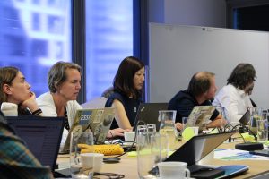
The IGARSS gathered more than 2500 scientists and experts in remote sensing worldwide under the theme “Acting for Sustainability and Resilience”. Image: AD4GD.
The International Geoscience and Remote Sensing Symposium (IGARSS) is an annual congress organized by the IEEE Geoscience and Remote Sensing Society gathering more than 2500 scientists and professions in the Remote Sensing field worldwide. The 2024 conference took place at the National Observatory of Athens (Greece) from the 7th to the 12th of July 2024 under the theme “Acting for Sustainability and Resilience”. The AD4GD projects has been particularly involved in this event with an oral presentation by CREAF researcher Ivette Serral, titled “Terrestial Connectivity based on Landsat/Sentinel Land Cover Classes as a Biodiversity Indicator for the European Green Deal Data Space”. A poster was also displayed on the topic of “Digital Twin ready data available in the Green Deal Data Space”.
Oral presentation: terrestial connectivity based on Landsat/Sentinel Land Cover Classes
The oral presentation led by Ivette Serral took place at the session FR1.R11.7 Advancing Earth System Digital Twins for Informed Decision Making I.
Terrestrial connectivity and integrity of natural ecosystems is a main concern in most of the current European and Global Green Policies, as the European Green Deal. Thus, public administration managers need reliable and long-term information for better monitoring and decision making. Data Spaces are intended to become the EC comprehensive solution to integrate data from different sources and natures with the aim to generate and provide a more ready to use knowledge. The presentation described two approaches for estimating and evaluating habitat terrestrial connectivity in Catalonia from a pixel and a vector basis and using data coming from different sources in 8 quinquennial periods from 1987 to 2022. New technical approaches for storing and distributing data such as the use of Open Data Cube, Cloud Optimized GeoTiff and OGC Web Services are also key in this context.

AD4GD has worked on two aproaches for estimating and evaluating habitat terrestrial connectivity in Catalonia from a pixel and a vector basis and using data coming from different sources in 8 quinquennial periods from 1987 to 2022. Image: AD4GD.
Poster: Digital Twin ready data available in the Green Deal Data Space
The poster display took place at the session FRPA.PA – Advancing Earth System Digital Twins for Informed Decision Making II.
It explored how to overcome data challenges in the Green Deal Data Space by producing Digital Twin Ready Data under the big data paradigm. Destination Earth (DestinE) is a flagship initiative of the European Commission to develop a highly accurate digital model of the Earth to monitor and simulate natural phenomena, hazards and the related human activities. The Green Deal Data Space is expected to organize available data in services and APIs that provide high priority Digital Twin Ready Data to the DestinE data lake.

The Green Deal Data Space is expected to organize available data in services and APIs that provide high priority Digital Twin Ready Data to the DestinE data lake. Image: AD4GD.
You can take a look at the full poster following this link:
About IGARSS 2024
IGARSS 2024 has been hosted by the National Observatory of Athens – Operational Unit “BEYOND Centre of Earth Observation Research and Satellite Remote Sensing” of Institute for Astronomy, Astrophysics, Space Applications and Remote Sensing, with the support of the National Technical University of Athens and the Foundation for Research and Technology – Hellas. IGARSS is organized by the IEEE Geoscience and Remote Sensing Society.