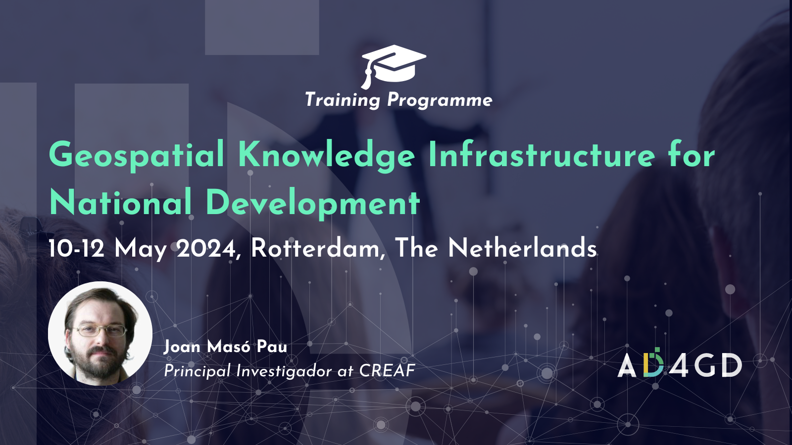
Training: Geospatial Knowledge Infrastructure for National Development
The adoption and integration of geospatial knowledge in critical economic sectors is crucial for national development. The Geospatial Knowledge Infrastructure (GKI) is moving up data to knowledge along the value chain diverging from the current emphasis on data infrastructures towards the establishment of knowledge infrastructures.
This training program hosted by the Geospatial World Forum will help develop enhanced understanding regarding the changing geospatial ecosystem and its convergence with the broader digital ecosystem, the geospatial knowledge value-chain and its role in sustainable development, the socio-economic impact of GKI, the evolving role of national geospatial agencies in digital age, the growing business and collaboration models, and the components of integrated geospatial strategiess.
The target participants of this training are related to topographic, hydrographic, land administration, geological or space agencies, as well as government geospatial data producers and providers.
Joan Masó, principal investigador at CREAF, OGC member and AD4GD coordinator will give lesson on data access and interoperability which includes insights about ppen data and licences, metadata, semantic and organisational interoperability, data quality assurance and dashboards, introduction to standards, integration of spatial, statistical data and meteorological data and application of APIs.
Speaker
-
 Joan Masó - CREAFPrincipal Investigador at CREAF and AD4GD Coordinator
Principal researcher leading the specialized group “Grumets” on geospatial interoperability, GIS, remote sensing. Since 1995 he is a researcher at CREAF and GIS developer. Co-creator of the MiraMon compressed map in 1997 that has evolved into a distribution and preservation format. Teacher in a RS and GIS master in the UAB. Creator of Remote Sensing imagery visualization and download software for web data portals (the MiraMon Map Reader).

Related News
- Three years of experience developing Green Deal Data Spaces: a chronicle of our final event
- Simplifying Data Accessibility: A Conversation with Pawel Babalski

- From University Project to the Green Deal Data Space: An Interview with Riyad Rahman

- Enhancing environmental data sharing: Policy brief Recommendations on Managing Data in the Green Deal Data Space